The Archive of Landscapes
Cultural heritage project
Search Results
48 results found with an empty search
- Medieval pathway of Prcanj | Article | Bogdan Kusevic | Bay of Kotor. Montenegro
The pathway is a proof of Prcanj’s historical development, of the time when the settlement was located on the upper levels of the Vrmac hill, resting on agriculture. A special way of treating the soil, preserving fertile humus layers, was achieved by the dry-stone wall techniques on terraced levels Medieval pathway of Prcanj, Montenegro The upper medieval path of Prcanj, from Glavati to Spille, with old churches on the hill and ruins of medieval houses, authentic farm estates and terraced gardens planted with olives as well as wooded areas between them, should be proclaimed, according to the wish of the residents, as protected landscape of special importance for the municipality of Kotor, as well as a valuable hiking tour. The area of the medieval path represents one of the few coastal areas in the interior of the Bay of Kotor, where the cultural landscape has not been attacked yet by commercial construction and where there is continuity from the sea Glavati) to the top of the mountain (Spille River Canyon). The pathway is a proof of Prcanj’s historical development, of the time when the settlement was located on the upper levels of the Vrmac hill, resting on agriculture. A special way of treating the soil, preserving fertile humus layers, was achieved by the dry-stone wall techniques on terraced levels along Vrmac slopes. Moving from the sea to the hill, ancient varieties of Mediterranean fruit, such as citrus, grapes, olives, figs, are still present. These authentic sloped terraces of autochthonous agricultural varieties are still preserved below the area of the upper medieval path connecting the Church of St. Anna with the church of St. Peter on the way to the Old Parish church toward Spilla river. There are also centuries old oaks and pine forests in the zones between the agricultural estates, which are also planted as old villagers can tell. On the top, this zone of settlement also shows several foundations of ancient family homes that date back to the Middle Ages, and in addition to the medieval paths, numerous ruins of churches and dry stonewalls are the material evidence of the medieval village of Prcanj which was located on the hill. The landscape of the upper medieval path of the Prcanj is of a great importance for settlement and it is necessary to point out its future conscientious management in order to maintain its outstanding universal value as an integral part of the UNESCO Natural and Culturo-Historical Region of Kotor. HOW TO CITE THIS ARTICLE: Kusevic, B. (2017). Medieval pathway of Prcanj , Montenegro ‘‘The Archive of Landscapes”. [date]. BIBLIOGRAPHY . BACKGROUND PHOTO. David Rumsey Historical Map Collection | The Collection; (1693) Disegno Topografico del Canale di Cattaro, Montenegro; Coronelli, Vincenzo (1650-1718).
- Kusevic thesis on POLIthesi | Bay of Kotor
Master thesis in the field of sustainable architecture and landscape design at university Politecnico di Milano, titled: The forgotten cultural landscape of Bay of Kotor. Valorisation of medieval path and ruins in Prcanj. Original research work published by Politecnico di Milano MSc thesis "THE FORGOTTEN CULTURAL LANDSCAPE OF BAY OF KOTOR. VALORISATION OF MEDIEVAL PATH AND RUINS IN PRCANJ." Author: Kusevic, Bogdan Supervisor: Redaelli, Gaia Co-Supervisor: Cabras, Nicola School/Department: ARC I - Scuola di Architettura Urbanistica Ingegneria delle Costruzioni, Politecnico di Milano Course: SUSTAINABLE ARCHITECTURE AND LANDSCAPE DESIGN - ARCHITETTURA SOSTENIBILE E PROGETTO DEL PAESAGGIO Disciplinary Sector: ICAR/15 ARCHITETTURA DEL PAESAGGIO Type of degree: Laurea magistrale Date: 27 July 2018. Academic year: 2017/2018 Thesis title: The forgotten cultural landscape of Bay of Kotor. Valorisation of medieval path and ruins in Prcanj Content language: ENG Publishing country: Italy Publisher: Politecnico di Milano BY CLICKING ON THE LINKS BELOW YOU AGREE TO THE ABOVE MENTIONED LAW ON INTELLECTUAL WORK AND AGREE TO THE GENERAL TERMS OF USE AND PRIVACY POLICY OF THE WEBSITE: ,, THE ARCHIVE OF LANDSCAPES'' Master thesis on POLItesi by Kusevic, B. click above to open the booklet
- Kotor | Montenegro | Photography | Bogdan Kusevic
Kotor is situated at the end of the Bay of Kotor in Montenegro, which is officially in the group of the most beautiful bays in the world. During the medieval times, Kotor became one of the most prominent cultural, economic, religious and trade centres of the southern Adriatic. The oldest archaeological remaining is the foundation of the early Cristian basilica from the 6th century below now existing Church of St. Mary of The River 2007-2017 Kotor (ita. Cattaro) cover photo: Kotor town ramparts Street musician in square of St. Luke in kotor, Montenegro - recorded by Bogdan Kusevic. August 2012 00:00 / 00:00 Kotor is situated at the end of the Bay of Kotor in Montenegro, which is officially in the group of the most beautiful bays in the world. During the medieval times, Kotor became one of the most prominent cultural, economic, religious and trade centres of the southern Adriatic. The oldest archaeological remaining is the foundation of the early Cristian basilica from the 6th century below now existing Church of St. Mary of The River. The first fortification was also established in the 6th century under the rulership of the Byzantine Empire. From 1185 to 1371, Kotor was under the rule of the Kingdom of Serbia. During that period, the first statute of the town was released in the year of 1301. Between 1391 and 1420, Kotor was an independent town - state. Afterwards, due to the threat of the Ottoman Empire and regular attacks by pirates, Kotor asked the Republic of Venice for protection, which was granted. Thus, Kotor with its surrounding territory became the province of the Venetian Republic from 1420 to 1797. During the Venetian protectorate, the town became a significant maritime centre in this region. In that period, most of its palaces were constructed in Baroque style by using building techniques with a strong influence of Venetian tradition. READ MORE on heritage article ''Bay of Kotor" Next
- Our Lady's Temple. Prcanj | Bay Of Kotor - Cultural Heritage Project | Prčanj
Most notable peace of sacral architecture in Prcanj is Church of the Blessed Virgin Mary. It was built in the Venetian late baroque style. The church is situated the the area of UNESCO Natural and culturo-historical region of Kotor. Our Lady Church in Prcanj was projected by the famous Venetian architect Bernardino Macaruzzi in 1789. 2007-2017 Our Lady's Temple cover photo: The dome of Our Lady's Temple in Prcanj Concert dedicated to Darinka Matić Marović in Our Lady's Temple in Prcanj . Academic Choir Collegium Musicum from Belgrade. August 16, 2022. - recorded by Bogdan Kusevic 00:00 / 00:00 Most notable peace of sacral architecture in Prcanj is Church of the Blessed Virgin Mary. It was built in the Venetian late baroque style. The church is situated the the area of UNESCO Natural and culturo-historical region of Kotor. Our Lady Church in Prcanj was projected by the famous Venetian architect Bernardino Maccaruzzi in 1789. The construction of the church started the same year but finished in 1913. The construction of the church was founded by the donation of twelve influential families from Prcanj, as well as donations of Austro-Hungarian government. The church at the time of construction was the biggest one in the South Adriatic region.Thes dome of the church is slightly lower that the dome of Dubrovnik Cathedral. The monumental staircase rising 25m above the sea is the highest artistic staircase of the East Adriatic. The church hosts numerous peace of art: icons, painting, reliefs of Venetian and EX Yugoslavian articts such as Milunovic, Rosandic, Lubarda, Mestrovic etc. Next
- Kotor | Article | Bogdan Kusevic | Bay of Kotor. Montenegro
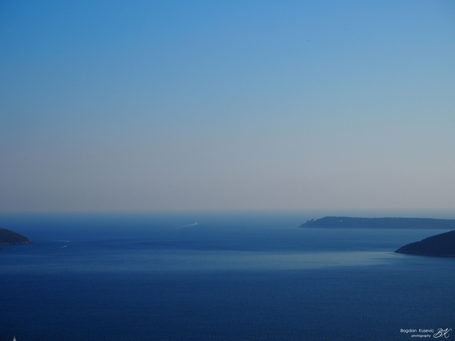
Bay of Kotor in Montenegro, is a very attractive tourist destination. It is considered to be one of the most beautiful bays in the world. The Bay of Kotor is rich in cultural heritage, and the town of Kotor, situated at the end of the bay is the most beautiful one. In this area, there are also very well-known Roman mosaics in Risan famous for its unique presentation of God Hypnos, along with the remains of Roman villas. Bay of Kotor Kotor-Historical timeline Bay of Kotor-timeline Bay of Kotor in Montenegro, is a very attractive tourist destination. It is considered to be one of the most beautiful bays in the world. The Bay of Kotor is rich in cultural heritage, and the town of Kotor, situated at the end of the bay is the most beautiful one. In this area, there are also very well-known Roman mosaics in Risan famous for its unique presentation of God Hypnos, along with the remains of Roman villas. The coastal settlements rapidly developed during Venetian protectorate of this region from 1492 to 1797. The most picturesque coastal in Bay of Kotor are Perast and Prcanj. The coastline in Bay of Kotor has been modified by building family piers in front of palaces and houses over the last two millennium. The population of the entire bay is around 60,000. Kotor is situated at the end of the Bay of Kotor in Montenegro. During the medieval times, Kotor became one of the most prominent cultural, economic, religious and trade centres of the southern Adriatic. The oldest archaeological remaining is the foundation of the early Cristian basilica from the 6th century below now existing Church of St. Mary of The River. The first fortification was also established in the 6th century under the rulership of the Byzantine Empire. From 1185 to 1371, Kotor was under the rule of the Kingdom of Serbia. During that period, the first statute of the town was released in the year of 1301. Between 1391 and 1420, Kotor was an independent town - state. Afterwards, due to the threat of the Ottoman Empire and regular attacks by pirates, Kotor asked the Republic of Venice for protection, which was granted. Thus, Kotor with its surrounding territory became the province of the Venetian Republic from 1420 to 1797. During the Venetian protectorate, the town became a significant maritime centre in this region. In that period, most of its palaces were constructed in Baroque style by using building techniques with a strong influence of Venetian tradition. The town has the longest fortification system in this region which was rebuilt by the Venetian Republic from 16th to 18th century. It protected the town during numerous Ottoman attempts to conquest the city. The most significant feat of architecture is St. Tryphon Cathedral built in 1166 on the remains of the old Roman basilica dated to the year of 809. Today, Kotor is a very attractive tourist and ship cruise destination. Over 500,000 visitors from cruise ships visit the town every year, which negatively affects the life of domicile population in many ways, and cause the high pollution of air and turbulence in marine ecosystem. The town itself has 2,500 inhabitants and it is the cultural capital of Montenegro. HOW TO CITE THIS ARTICLE: Kusevic, B. (2017). Bay of Kotor, Montenegro ‘‘The Archive of Landscapes”. [date]. BIBLIOGRAPHY . BACKGROUND PHOTO. Coats of arms of Beskuca family, Prcanj, Montenegro. Photo by Bogdan Kusevic;
- Bay Of Kotor | Cultural Heritage Project 2017 | Prčanj
Bay of Kotor in Montenegro, is a very attractive tourist destination. It is considered to be one of the most beautiful bays in the world. The Bay of Kotor is rich in cultural heritage, and the town of Kotor, situated at the end of the bay is the most beautiful one, where the most ancient Cathedral in eastern Adriatic called St. Tryphon Cathedral has existed since 1166. In this area, there are also very well-known Roman mosaics in Risan famous for its unique presentation of God Hypnos 2007-2017 Bay of Kotor seascape photography cover photo: The islets in front of Perast, Montenegro Bay of Kotor in Montenegro, is a very attractive tourist destination. It is considered to be one of the most beautiful bays in the world. The Bay of Kotor is rich in cultural heritage, and the town of Kotor, situated at the end of the bay is the most beautiful one, where the most ancient Cathedral in eastern Adriatic called St. Tryphon Cathedral has existed since 1166. In this area, there are also very well-known Roman mosaics in Risan famous for its unique presentation of God Hypnos, along with the remains of Roman villas. The coastal settlements rapidly developed during Venetian protectorate of this region from 1492 to 1797 and the most picturesque towns are Perast and Prcanj. The coastline in Boka Kotorska has been modified by building family piers in front of palaces and houses. The population of the entire bay is around 60,000. Next
- Ulica Lukovica | Prcanj | Article | Bogdan Kusevic | Bay of Kotor. Montenegro
Lukovic Street was the core of the public life of the 16th and 17th century. It is named after the Lukovic family houses, which have exceptionally elegantly decorated stone balustrades; the palaces follows the sea line, merging into the street front, and making a unique and indivisible ambient Street of Lukovic family - Prcanj Lukovic Street, with its luxurious palaces overlooking the sea, the Captain’s house with as many as 12 baroque balconies, and the ancient stone paving along the entire street front, according to numerous historians is at the very top of the artistic expression of the baroque profane architecture of streets in the South Adriatic. Lukovic Street was the core of the public life of the 16th and 17th century. It is named after the Lukovic family houses, which have exceptionally elegantly decorated stone balustrades; the palaces follows the sea line, merging into the street front, and making a unique and indivisible ambient unit in a functional and aesthetic domain. Opposed to the houses towards the sea, so-called ‘ponta’ were made over the time, for accessing sailboats with a plateau on which cargoes from ships were landed, as well as small ports for binding family boats. The coastal belt was an indivisible private space and made up a whole with the palaces. In the later period, around 1805, when this region was already under the Austro-Hungarian empire, the emperor had the first coastal road built along the sea for military needs, thus completely interrupting the continuity of family gardens from the sea to the houses. This act changed forever the character of space, dividing it into two parts, one made up of family ports for boats with berths along the sea, and another made up of a paved street of the Lukovic family. The seafront, including ponta and boat bindings, were private properties in the 19th century, characterized by traditional stone bindings, stone paving and stone sea-shores, with small gardens rich in Mediterranean vegetation. On the opposite side of the houses, there are elegant courts (avlije) with greenery, authentic stylish furniture and paved paths. Each ‘avlija’, or, artistic yard, has its own water well with a baroque stone hood; the pavement from the house to the well features square plates of red and white stone, and each yard shows parts of artistic gardening masonry such as stone sinks and verandas on the stone pillars with capitals. The entire area is an example of an authentic traditional urban settlement that had all the elements of urban character with a paved street, a ship’s harbour, a church and a very strong influence in the cultural movements of this region. In the last decade, many palaces and captains’ houses have been subjected to unprofessional restorations. Traditional roofs have been opened for the balcony, baroque balconies have been divided by concrete slabs, houses have built where does not exist before, and the coastal line was rebuilt by building new concrete piers and harbours. Due to this all, today it is necessary to approach the integral protection of this region to preserve its original artistic and historical value and to protect it on a larger scale as a whole authentic ambient. Furthermore, it is extremely necessary to prepare an integral plan for the protection of the wider zone that affects the Lukovic Street, from the sea and the family ports, through the street front to the palace, with yards and fields behind the houses to the contact surfaces that touch the forests of Lekovina. All of this together should be included in the whole area of cultural landscape protection to avoid negative visual impacts on the very street of Lukovica, and in that way to avoid jeopardizing its outstanding universal value. HOW TO CITE THIS ARTICLE: Kusevic, B. (2017). Street of Lukovic family - Prcanj . ‘‘The Archive of Landscapes”. [date]. BIBLIOGRAPHY . BACKGROUND PHOTO. David Rumsey Historical Map Collection | The Collection; (1693) Disegno Topografico del Canale di Cattaro, Montenegro; Coronelli, Vincenzo (1650-1718).
- Prcanj | Article | Bogdan Kusevic | Bay of Kotor. Montenegro
Town of Prcanj in Kotor municipality in Montenegro is coastal town traditionally relied on the sea trade that even nowadays preserved its inherited character. Historically, the first mentions were at 1222 due to the building of St Johan church, during the medieval age town exists in the upper level Prcanj, Montenegro Prcanj in Kotor municipality in Montenegro is a coastal town which traditionally relied on the maritime trade and such tradition has remained to the present day. Historically, the first mentions of it were in 1222 in the correspondence regarding the construction of St Johan Church. During the medieval age, the town was being developed in the upper level in the hill and it relied primarily on the local agriculture. Later, at the beginning of the 15th century, the town rapidly started to develop in the coastal region. Prcanj sailors from early 15th century demonstrate the town’s tremendous skillfulness at the sea, witnessed by state Venetian captains. Maritime trade was very active and successful and made a lot of families from Prcanj exceptionally rich (for example, the Beskuca family owns 99 houses in the Bay of Kotor and overseas). Maritime trade flourished during 16th and 18th century; the ships owned by people from Prcanj grew in size and number so that by the end of the 18th century, Prcanj was a home port for 98 overseas ships. Prcanj’s wealthiest sea captains’ families names were: Lukovic, Gjurovic, Sbutega, Lazzari, Mihnic, Florio, Verona, Milin, Petkic, Raffaeili, Beskuca, Marassi. Many of them had their trade houses and family residences in Venice, Trieste, Corfu, Thebes, Corinth, Alexandria, Algiers, etc. Among their most common merchandise were Montenegrin and Greek cheese, Dalmatian vine, oil candles, salted sardines, dry meat, dry figs, Dalmatian and Greek olive oil, and silk. Their most frequent ports of call were - apart from the eastern Mediterranean ones - Ancona, Bari, Brindisi, Venice, and Trieste. The success of maritime trade was so immense for Prcanj that by the end of 17th century it had overpassed, in economic terms, the medieval town of Kotor (Cattaro in Italian), which had often helped them giving money and manual labour in times of crisis. After the catastrophic earthquake of 1667, by which Kotor was almost completely destroyed, Prcanj’s sailors and shipowners volunteerely helped repairing the destroyed town with money and labour, even providing free transport of goods on their ships. In 1420, after several attempts to form an alliance with the Venetian Republic, Kotor’s Governors finally received a positive response and gained the Venetian protection. As it was due in time of war, Prcanj’s Governors aswered to the city’s assistance request providing a free mobilisation, and sailors always went to the sea battlefield against enemies with other Venetian provinces on Adriatic. Thanks to their extremely high faithfulness in naval battles and in sustaining safe sea-trade, all the Prcanj’s captains gained numerous benefits. For example, in 18th century Prcanj’s sailors and ship-owners got free merchandise, without any charge, available on Venezia and Padova, and tax-free trade. In 1420 the Bay of Kotor was not entirely under Venetian protection; in fact, the only inner area with the towns of Kotor, Dobrota, Mulla, Perzagno, Stolivo, Perasto, and Sterp was. Other areas of Bay of Kotor, such as Castel Nuovo and Risano, become Venetian provinces following the Liberation from the Ottoman rule in 1687. Already at the end of the 16th century, sailors from Prcanj stood out with their ships (fusta) on sails and oars which overpassed the Venetian State ships, as witnessed by the Venetian governor-general Almorò Tiepolo (1593). In fact, by the end of the 16th century, due to their tremendous skillfulness at the sea, the administration of the Venetian Republic decided to give to Prcanj’s captains the great responsibility to transport State mail (pubblici dispacci) on their ships. The decision, come into force in 1625, has brought many benefits to the population of Prcanj, such as relieving them from military service and physical, manual labour. On the other hand, the importance of a reliable postal service, ranging from Venice to Zadar and Kotor and even to Corfu, was of immense importance for the Republic of Venice.The ships carrying mail were small in size and their crew numbered nine members. The privileges of the city grew thanks to this extraordinary role, and in 1704 Prcanj received the statute of Municipality (Comunità di Perzagno). This decision of the Republic resulted in huge benefits, namely the abolition of customs, which strengthened the economic growth that inncreased the city’s maritime economy. Prcanj is located at the foot of Vrmac hill and due to the mixture of sea and mountain air it has been renowned as a health resort for a long time. The settlement is well-known for its unique fresh air suitable for people with lung diseases and allergies, which was recognized at the congress of Yugoslavian pulmonologists in 1920s. The sanatorium for non-specific pulmonary diseases was situated in the area of Lekovina, which has special microclimatic benefits, until the 1979 earthquake.Today Prcanj is well-known as a health resort, and it attracts many visitors seeking for health improvement, sports training and family holiday in the peaceful scenery along the coast. It has a population of around 1,100. HOW TO CITE THIS ARTICLE: Kusevic, B. (2017). Town of Prcanj, Montenegro . ‘‘The Archive of Landscapes”. [date]. BIBLIOGRAPHY . BACKGROUND PHOTO. David Rumsey Historical Map Collection | The Collection; (1693) Disegno Topografico del Canale di Cattaro, Montenegro; Coronelli, Vincenzo (1650-1718).
- Old Parish Church. Prcanj | Bay Of Kotor - Cultural Heritage Project | Prčanj
The most beautiful church complex on the upper medieval path of Prcanj is the Old Parish Church. Today, the major part of the church is in ruins because it suffered tremendous devastation during the earthquake which occured in 1979. The church ensemble consists of an old cemetery, a monumental stone wall towards the sea which was laid down as a foundation of the whole complex, a unique octagonal dome, and the church building together with the residence of the parish palace 2007-2017 The ruins of the Old Parish church of Prcanj cover photo: Old parish c hurch of Prcanj The most beautiful church on the upper medieval path of Prcanj is the Old Parish Church. Today, the major part of the church is in ruins because it suffered tremendous devastation during the earthquake which occured in 1979. The church ensemble consists of an old cemetery, a monumental stone wall towards the sea which was laid down as a foundation of the whole complex, a unique octagonal dome, and the church building together with the residence of the parish palace, which is now completely in ruins. This church was mentioned for the first time in the documents dated 1399 as Ecclesia Sctae Mariae de Parzana. It was reconstructed in 1672 and after that, an octagonal chapel with a dome was built in 1740. READ MORE on heritage article ''Old Parish Church of Prcanj" Next
- Dobrota | Bay of Kotor | Cultural Heritage Project 2017
During the time of Venetian rule, Dobrota was an autonomous town, together with Kotor, Prčanj and Perast. The prominent families of Dobrota who marked the social and economic history of their homeland were Dabčevići, Dabinovići, Ivanovići, Kamenarovići, Radimiri, Tripkovići and others. Dobrota relied on maritime trade and at the beginning of the 19th century it was one of the leading maritime centres in Bay of Kotor 2007-2017 Dobrota town of sea captains cover photo: Dobrota, seen from a family pier During the time of Venetian rule, Dobrota was an autonomous town, together with Kotor, Prčanj and Perast. The prominent families of Dobrota who marked the social and economic history of their homeland were Dabčevići, Dabinovići, Ivanovići, Kamenarovići, Radimiri, Tripkovići and others. Dobrota relied on maritime trade and at the beginning of the 19th century it was one of the leading maritime centres in Boka and the east coast, counting 35 ships with a total weight of 5,172 tonnes and having 443 registered crew members. Dobrota families became very powerful and all aspects of social and cultural life moved from Kotor to Dobrota. However, Napoleon’s conquest caused crisis in maritime trade. The naval blockade occurred, the ships were wrecked by the French and the English army and the old trade links were interrupted. The Austrian authorities did not bring much improvement, and the first attempts of recovery occurred after 1850. Next


