The Archive of Landscapes
Cultural heritage project
Search Results
48 results found with an empty search
- Heritage | Bay of Kotor | Bogdan Kusevic | Cultural heritage in danger
In the last decade region of Bay of Kotor, which is UNESCO heritage site from 1979. is the area of severe destruction of the cultural landscape due to the excessive building industry, triggered by huge investments... The cultural landscape in danger of UNESCO Natural and Culturo-historical region of Kotor Over the last decade, the region of the Bay of Kotor, which has been the UNESCO heritage site since 1979, is the area where severe destruction of the cultural landscape has occurred due to the excessive building industry, triggered by huge investments. Such appalling development of the entire Bay is threatening to devastate the fragile cultural landscape of the Bay of Kotor. Because of excessive destruction of the outstanding universal value of the cultural landscape, traditional urban settlements are endangered by the over-scaled architecture for commercial purposes. As a result of this, the UNESCO Natural and Culturo-Historical Region of Kotor will probably soon be erased from the World Heritage list. It should also be pointed out that Boka Kotorska is a place where cultures overlap due to Roman, Byzantine, Venetian and Austro-Hungarian rule. Thus, the complexity of the landscape and its connection to the past eras is a strong argument for its valorisation by integrative approach which would first consider the social value of the cultural landscape. Such an approach to the overall socio-historical development of the region also has to contain the environmental component in many areas of management of landscape and urban planning. Nowadays native people have lost connection with the local environment in Bay of Kotor; this has happened by changing the way people use landscape and by vanishing the active cultivation of the same. Moreover, the way the landscape is used has drastically changed after the last earthquake in 1979; furthermore, over the last decade it has been highly influenced by the heavy foreign investment in real estate industry.For all these reasons, the cultural landscape of the Bay of Kotor region, and Prcanj in particular, is under the big threat of losing all its inherited features represented by the materiality and the structure of the landscape itself, as well as vanishing the collective memory of its traditional character and specificity. Today, many areas have been devastated by building residential buildings without any legal certificate, thus imposing high seismic hazard; also, by interrupting the organical linkage with surrounding landscape; even, by making life more complicated and dangerous (neglecting the necessity of adequate access for personal cars, or not providing a livable neighbourhood). All these problems make a real urban chaos in some upper areas of Prcanj like Tre Sorelle and Sarena Gomila. After the 1979 earthquake, an intensive urbanisation started without any implemented strategical urban planning. Today, some areas in Prcanj which are important for their cultural landscape, like St. Anna Valley, are threatened by uncontrolled urbanisation, like the building of a big real estate settlement, and by imposing the complete destruction of the authentic cultural landscape. Now the urge for urban legislation of the entire UNESCO area of Kotor, as well as in Prcanj, is the top priority for Montenegro, and among the aims of this report is to point to urgent actions in urban legislation and integrated approach toward cultural landscape protection, as well as to raise public awareness about its tangible and intangible features. Due to excessive construction, the authenticity of the Region of Kotor is fading away and is rudely devastated in the name of sustainable development. However, in this case the concept of sustainability has been compromised from the very start. Such a problematic approach of urban planning is evident on the entire coast of Montenegro but it is most obvious in the region of Kotor, which is under the protection of the UNESCO. I would like to point out that the town of Kotor with its surroundings is in a chaotic situation now. Abandoned spots in the town of huge potentials such as the old abandoned site of the factory, ruins of Fjord Hotel, the modernist building of Jugooceanija, a former shipping company, and a lot of other areas of the huge potentials such as Skurda peninsula, and sports hall in Skaljari, and the building of former Autoremont are wrecked. At present, the town attempts to improve its economy by hosting big cruise ships. In that respect it has been very successful insomuch that Kotor has been proclaimed as the one of the top 5 cruising ship destination in the Mediterranean. Far more interesting topic is opening for mass tourism. Namely, every day thousands of tourist come to the Kotor, which has only 2,000 inhabitants. Does the town need so many tourists come for one day sightseeing tour, or better to say half day sightseeing tour? Does it mean that the citizens would not be able to come to the town centre during working hours or to reach the health institutions in proper time because of crowded streets? Kotor is the town that has only one road which runs along the waterfront. Due to numerous vehicles which travel along this road, traffic congestions frequently occur, especially in summer. Furthermore, the local seashore roads are without the proper signalization, with holes, pits and bumps, which makes the transportation, from Tivat to Kotor in particular, very annoying and frustrating but also very dangerous. All these issues and historical permanence in a collision with the current mass cruise tourism cause many problems. An average tourist who would like to spend a couple of days in Kotor cannot properly enjoy his or her vacation. It means that smart mobility needs to be introduced in the immediate vicinity to provide a liveable environment for the younger generation to come but also for its well-recognized tourist activity in the town of Kotor. Furthermore, cruise ships cause problems which must be solved urgently because of their adverse effect on the environment. They produce air pollution and damage the marine ecosystem in many ways which have a negative impact on the fishing industry, and thus cause the socio-economic turbulence that leads to complete relocation of domicile population. In addition to this, there are many problems arising from the improper regional planning, whereby high buildings have been constructed in the pristine cultural landscape proclaimed as the World Cultural Heritage. The following key points highlight the issues arising from the ongoing building activities that have negative impact on the protected area of the Bay of Kotor and pose a threat to its Outstanding Universal Value. Emerging of poorly planned settlements in UNESCO Natural and Culturo-Historical Region of Kotor, which poses a threat to the outstanding universal value of property Building of improperly planned settlements without any urban strategy or management plan, which makes an unprecedented negative visual impact on the seashore line and vistas on the historical monuments and urban ensembles of outstanding universal value; Settlements planned and made in locations not suitable for their character because of the unique and practically harsh natural environment in the region of seashore forests and cliffs, which ruins the integrity of the landscape itself; Settlements built without any prior strategy, thus living in them may be dangerous and complicated because of pollution of water, environmental degradation, ecosystem collapse, a danger of forest fires, high seismic risk etc.; Accepting the urban plan that proposes big and radical intervention in the landscape, that might probably invade the integrity of the cultural landscape and destroy its outstanding universal value by building a traffic motorway, a bridge or other large infrastructural elements for which consulting with UNESCO experts and making Heritage Assessment plan is necessary. Building contemporary structures in a landscape that is not suitable for them because of its characteristics, design or terrain feature, which has a negative and unprecedented impact on the entire cultural landscape and natural scenery; The non-professional or cheap commercial buildings made without any legal certificate that threatens to destroy the unique traditional way of life of local people; Concreting the seashore at the places of former family piers or building new ones without using the traditional monolith stone techniques, destroying the fertile sea ecosystem and artistic traditional appearance of the sea line; Destruction of traditional olive and oak forests, traditional steep agricultural terraces and traditional historical-artistic gardens of outstanding value behind the palaces and family homes; Non-professional restoration of protected historical family buildings without any regard for their integrity, which threatens to degrade the universal value of the buildings (opening the roof terraces, division of historical balustrades, altering the height of historical buildings, houses or palaces, making the roof covering with non-traditional techniques, changing the traditional bearing construction (especially the concrete ones), changing the original look of the facades, replacing the traditional wooden openings for doors and windows) with the ones made of PVC, AL,...etc.; Degradation of the value of historical palaces and their ancient artistic furniture, interior decorations, aristocratic family libraries and artistic paintings, because of: leaving the property without owners, multiple selling of the property to foreign investors that neglect its historical value and the lack of the regulations and statistics data of movable cultural treasures and regulations for itself. HOW TO CITE THIS ARTICLE: Kusevic, B. (2017).The cultural landscape in danger of Bay of Kotor ‘‘The Archive of Landscapes” . [date] BACKGROUND PHOTO. Dobrota, Montenegro. Photo by Bogdan Kusevic Degradation of integrity of the cultural landscape in the town of Prcanj, Dobrota, Kostanjica Photographs by Bogdan Kusevic Degradation of monuments of UNESCO Natural and Culturo-Historical region of Kotor Photographs by Bogdan Kusevic
- CV | Bogdan Kusevic | Bay of Kotor | Cultural heritage project
Bogdan Kusevic is an architect based in Kotor. In July 2018, he obtained the master’s degree in sustainable architecture and landscape design at Politecnico di Milano. Before that, he acquired a bachelor’s degree and a specialist’s degree in architecture at the University of Montenegro - the Faculty of Architecture, where he studied between 2010 and 2015. Bogdan Kusevic Architect conservator Specialist in Architectural and Landscape heritage Ex. Student of the Post -graduate School of Architectural and Landscape heritage, Politecnico di Milano Updated on: 14.05.2026. From the author... "Dealing with architecture for me is dealing with culture because architecture is supposed to reflect the cultural code of a particular society. My work is based on understanding of people’s needs by taking into consideration the needs of an individual first and then the collective needs. For me, architecture is so similar to poetry, a manifestation of the mind in its high awareness, often subconscious one but always existential one which clears its path towards others in spaces of collective memory. When I design, I always put permanence of architectural heritage to serve as a concept upon which contemporary design finds its own way. Thinking, writing, drawing and planning is my methodology of design whereby architecture should correspond with the existing built environment and as well as with nature and society so that it could take on an identity worthy of a man of the 21st century." Bogdan Kusevic, architect conservator Work Experience May 2014 - Jul 2024 December 2018 - October 2023 Architect conservator - internship 200h - part-time May 2014 - Jul 2024 Studio Redaelli Speranza Architetti Associati Via Pietro Colletta 29, 20135 Milano, Italy Conducted investigation, survey, and preliminary analysis of buildings forming part of a castle in the Province of Piacenza (Municipality of Calendasco ), which are protected under Legislative Decree 42/2004. The investigations supported a subsequent project for the securing, restoration, and adaptive reuse of part of the castle within a broader initiative promoted by the Municipality, under the supervision of the Superintendency of Parma and Piacenza. Architect and conservator architect by contract December 1. 2018 - October 16. 2023 Enforma d.o.o. - www.enforma.me Jadranska magistrala bb. Kotor, Montenegro Developing concept designs and main conservation projects of fortification and residential architecture in Montenegro. Also conducting research studies of memorial architecture in Montenegro. Conducting historical, architectural and genealogical research. A member of the project team in the following architectural, conservation and research projects, among them notable ones as follows: Preliminary design for the reconstruction of the fortress Kosmač (Budva). GFA 3002.95 m2 The main architectural conservation project of the Florio - Lukovic Palace (Prčanj). GFA 527.54 m2 The main executive project of the building reconstruction in its existing dimensions – turning a cultural heritage of the Španjola Fortess into an international creative hub (Herceg Novi). GFA 5178,27 m2 (2022) International competition (the winning design) for the reconstruction of the cultural heritage of the Španjola Fortress (Herceg Novi). GFA 5178,27 m2 (2020) Preliminary design and main conservation project for the reconstruction, rehabilitation and restoration of the Visković Palace – the Visković Family Museum (Perast). GFA 912.17 m2 (2019) Preliminary design for the reconstruction of the existing facility - “Town`s rampart - remains of the town of Onogošt” (Nikšić). GFA 1934,10 m2 (2019) Preliminary design and main conservation project for the reconstruction of the St. Cross Fortres s (Perast). GFA 828.57 m2 (2019) October 2018 - December 2018 Apprenticeship October 1. 2018 - December 1. 2018. Enforma d.o.o. - www.enforma.me Jadranska magistrala bb. Kotor, Montenegro Assistance on the preliminary design of St. Cross fortress in Perast. September 2018 - Apprenticeship - Sept. 2018. Studio Redaelli Speranza Architetti Associati Via Pietro Colletta 29, 20135 Milano, Italy Urban and interior rendering design for the regional competition of Emilia Romagna - Valorisation of Via Francigena. Won the competition. September 2016 - Internship - Sept. 2016. Expeditio - Center for Sustainable Spatial Development Skaljari bb, 85330 Kotor, Montenegro Assistance on the project: Study of protection of cultural heritage in natural reserve ”Tivatska Solila’” in Tivat, Montenegro July 2014 - August 2014 Student traineeship - July - Aug. 2014 Atelier Pulsarh d.o.o. Molerova 37, 11111 Belgrade, Serbia Assistance on the several individual housing projects Education: Octobar 2015 - 2018 Master (MSc) degree in Sustainable Architecture and Landscape Design (degree class n. LM - 4 Building engineering - architecture) Politecnico di Milano, Scuola di Architettura, Urbanistica e Ingegneria delle Costruzioni, Via Scalabrini 76, 29121 Piacenza, Italy Graduation thesis: Score: 104/110 - July 2018. “The forgotten cultural landscape of Bay of Kotor. Valorisation of medieval path and ruins in Prcanj” September 2006 - June 2010 High school degree - June 2010. High school - Classical Lyceum ,,Gimnazija Kotor’’ in Kotor, Montenegro. Final exam passed with score 4.75/5.00 September 2010 - July 2014 Bachelor (BSc) degree in Architecture - July 2014. University of Montenegro, Faculty of Architecture, Bulevar Dzordza Vasingtona, 81000 Podgorica, Montenegro September 2014 - Sept. 2015 Specialist (Spec.Sci.) degree in Architecture - Sept. 2015. University of Montenegro, Faculty of Architecture Bulevar Dzordza Vasingtona, 81000 Podgorica, Montenegro Graduation project score 10.0/10.0 with title: ,,Museum of Kotor’’ City museum with parking garage November 2023 - present Politecnico di Milano Scuola di specializzazione in Beni architettonici e del paesaggio Post - Graduate School in Architectural and Landscape Heritage Address Politecnico di Milano – DAStU Via Bonardi n.9, Edificio 14, "Nave", Seminterrato, Milano, 20133, Milan, Italy Website: https://www.ssbap.polimi.it/ https://www.polimi.it/formazione/scuola-di-specializzazione Field of study: "Protection, cataloguing, restoration, maintenance, management and enhancement of cultural heritage, with particular reference to architectural and landscape heritage, at the scale of individual buildings, historic centres, infrastructure and the built environment of the landscape, in both its tangible and intangible aspects." Award of the scholarship: Scholarship on territorial vulnerabilities awarded to the most outstanding candidates enrolling in the SSBAP for the academic years 2023/2024 and 2024/2025. CRAFT - Competence Center Anti-Fragile Territories, Politecnico di Milano Final grade: 100/100 Cum Laude Thesis: "The Village of Spigliari in Montenegro - Endangered Heritage within the UNESCO World Heritage Site. Analytical Studies with Conservation and Protection Proposals" - L'antico villaggio di Spigliari in Montenegro: un’eredità a rischio all'interno del perimetro UNESCO. Studi conoscitivi e proposte di tutela Level of qualification: EQF level 8 Number of credits: 120 CFU/ECTS Publications: January 2021 - January 2021 - “Cemetery“ tourism study Authors: Marija Novakovic, Bogdan Kusevic, Slaven Radimiri Levi Partner institutions: Municipality of Kotor, Jewish Community of Montenegro Kotor. - Jan. 2021. The publication Cemetery – A Study of Tourism analyses the historical development of the Škaljari cemetery. A special section of the publication presents an architectural and stylistic study of the Jewish cemetery located within the same complex, with the aim of identifying a model for its future cultural valorisation. Link to this publication: https://www.significantcemeteries.org/2021/06/cemetery-tourism-study-at-city-cemetery.html "Jews in Kotor following the archive records from XV- XX Century" Authors: Marija Novakovic, Bogdan Kusevic Partner institutions: Municipality of Kotor, Jewish Community of Montenegro Kotor. - Jan. 2021. The publication "Jews in Kotor following the archive records from XV - XX Century" aims to rediscover the forgotten Jewish cultural heritage in the municipality of Kotor. The project includes historical and archival research, as well as genealogical investigations into the Jewish population present in the area between the 19th and 20th centuries. Link to this publication: https://www.kotor.me/me/jevreji-u-kotoru---jews-in-kotor/ Exhibitions: January 2021. - September 2022 Jewish tangible and intangible cultural heritage in Kotor Temporary exhibition: The authors of the exhibition: Studio Enforma doo - Marija Novakovic and Bogdan Kusevic Partner institutions: Municipality of Kotor, Jewish Community of Montenegro Exibition displayed on: • The second book festival – "FesK" Kotor - 09. 2022. • European Days of Jewish Culture in Pljevlja - 09. 2022. • Jewish Conference "Mahar" in Budva - 10. 2021. • Naval Museum of Montenegro - Kotor - 01.2021. Workshops: July 2016. December 2015. Invisible LANDSCAPES: An architectural game. Politecnico di Milano. International one week workshop. Piacenza, Italy 1st BISHOP CITIES. Politecnico di Milano. Strategic nodes with a relevant role in the sustainable growth and liveability of the metropolitan regions. Piacenza, Italy State exams: The examination of professional competence to perform the activities of drawing up of technical documentation and construction activities. 31.05.2023 State exams: The examination of professional competence to perform the activities of drawing up of technical documentation and construction activities. 31.05.2023 - Ministry of Spatial Planning, Urbanism and State Property The professional exam for the professional title of conservator. 27.10.2023. - Ministry of Culture and Media of Montenegro Licenses: Authorized engineer’s license to perform activities of drawing up of technical documentation and construction activities. 28.06.2023. Driving licence B2 Language skills: Mother tongue (s): Montenegrin, Serbian, Croatian Foreign languages: English B2, Italian B2 Curriculum Vitae Bogdan Kusevic
- Footpath Muo - Prcanj - Stoliv | Bay of Kotor
The old footpath Muo - Prcanj - Gornji Stoliv, which is believed to have been active during the Middle Ages, used to connect the old settlements in the hills with the settlements along the coast as there were no coastal roads yet. Its numerous access paths, going upward from the sea, in a form of staircases and sloping cobbled ramps, most often lead to the parish churches in the hill The old footpath Muo - Prcanj - Gornji Stoliv The footpath to the church of Saints Cosmas and Damian above the village of Muo The footpath to the church of Saints Cosmas and Damian above the village of Muo Ruins of old houses along the path towards the Church of Saints Cosmas and Damian The church of Saints Cosmas and Damian The view from the path Muo - the Church of Saints Cosmas and Damian Ruins of old houses along the path above the village of Muo Ruins of old houses along the path above the village of Muo The path above the former military complex in Prcanj The path above the village of Muo The access path Velja Rijeka - Glavati - Prcanj The path past the Church of St. Anna to Glavati The ruins of the Sbutega Palace – the Glavati cove near the church of St. Anna The view from the path near the cove of St. Anna The path past the church of St. Peter above Prcanj The path towards the ruins of the old parish church above Prcanj The path past the ruins of the old parish church above Prcanj The ruins of the old parish church above Prcanj The old parish church in Prcanj The path towards the locality Grasovo – Prcanj The path towards the locality Grasovo – Prcanj The view from the path Grasovo - Markov Rt The path towards Gornji Stoliv The path towards Gornji Stoliv The Church of St. Elijah in Gornji Stoliv The view from the path Gornji Stoliv - Markov Rt The old footpath Muo - Prcanj - Gornji Stoliv, which is believed to have been active during the Middle Ages, used to connect the old settlements in the hills with the settlements along the coast as there were no coastal roads yet. Its numerous access paths, going upward from the sea, in a form of staircases and sloping cobbled ramps, most often lead to the parish churches in the hill. The most important branches are the path from the village of Muo to the Church of Saints Cosmas and Damian, the path from the village of Prcanj in the locality of Grasovo to the ruins of the old parish church in the hill and the path from Donji Stoliv to the Church of St. Elijah in Gornji Stoliv. These footpaths branches had the important religious role in the life of the people in this region, so that we can even talk about their pilgrimage character. A typical example is a path to the old parish church on the hill above Prcanj, where a miracle-working icon of the Mother of God was located, before it was moved to the Church of the Virgin by the sea, and where it was visited on feast days by up to 6,000 believers. A footpath in the hill, Muo - Prcanj - Gornji Stoliv, starts in the coastal part of the village of Muo. Near the Church of Saints Cosmas and Damian, this path branches towards Prcanj, and then extends above the former military complex, but it is mostly impassable. The path continues above the settlement of Glavati, passes by the old houses, and over Velja Rijeka and descends into the cove of St. Anna. Then, it runs by the old inhabited houses in the hill and continues past the ruins of the old Prcanj parish church and continues all the way to Gornji Stoliv. Unfortunately, the section from Muo to Glavati is completely impassable and unmarked, and it has not been maintained for years. This segment of the footpath should certainly be included in the Boka Kotorska hiking tour plan. This year, (May 2021) due to overgrown vegetation, a part of the footpath in Prcanj is not accessible, in the area of Velja Rijeka - St. Anna - Mondov Potok, as well as part of the path in the locality Grasovo - Markov Rt - Gornji Stoliv. The footpath Muo - Prcanj - Gornji Stoliv is significant in several ways for the study of the history of these settlements and it belongs to the most interesting ones because it offers several kilometers of continuous panoramic views of the Bay of Kotor. It passes further by the oldest remains and ruins of houses in the hill, built of the stone walls between one and two meters thick. These houses are the most visible in the upper part of the village of Muo oriented toward Prcanj. There are ruins of the old medieval houses along the path in the cove of St. Anna, then along the path after passing the Church of St. Peter in Prcanj, as well as along the path from the village of Muo to the Church of Saints Cosmas and Damian. Likewise, there are numerous family chapels and churches on the route Muo - Prcanj - Gornji Stoliv, many of which are in ruins. The landscape value of the footpath is reflected in the authentic construction techniques, in the combination of steps carved into the rock and stone steps, in addition to the cobbled stone ramps, and high dry-stone walls that follow and change the level of the path along the terraced agricultural land. Such wall systems are most present on the section of the footpath from Muo to the Church of Saints Cosmas and Damian, then from Grasovo to the old Prcanj church in the hill as well as the site of Mondov Potok - Prčanj. The special character and the beauty of the footpath Muo - Prcanj - Gornji Stoliv lies in small altitude changes, as it runs through various types of landscape from rock and sedge, olive groves, pine, oak and chestnut forests to pastures with authentic agricultural varieties and old stone houses in the hills. The value of the footpath is also reflected in the numerous ruins of both residential and sacred architecture, which are a real asset for their future valorization and an opportunity to revive the "low - carbon" tourism and portray the authentic way of life of the people from this region from the ancient times to the present day. HOW TO CITE THIS ARTICLE: Kusevic, B. (2021 ). The old footpath M uo - Prcanj - Stoliv ‘‘The Archive of Landscapes”. [date]. BIBLIOGRAPHY . BACKGROUND PHOTO. David Rumsey Historical Map Collection | The Collection; (1693) Disegno Topografico del Canale di Cattaro, Montenegro; Coronelli, Vincenzo (1650-1718).
- Church of St. Anna | Bay of Kotor
The church of St. Anna is believed to be existing here since the 14th century, and the ruins of the parish house in the immediate vicinity are the most ancient remains of residential buildings in the town of Prcanj. The church of St. Anna is situated 100 m from the sea on the hill of Vrmac Church of St. Anna - Prcanj, Montenegro Medieval churches like that of St. Anna in Prcanj, dating back to the 14th century, feature small-sized, not sophisticated, elegant proportions, as well as picturesque forms with a very interesting way of integrating into the landscape. In the Middle Ages, the Gothic style was not developed enough here, even though it was too much postponed compared to other urban centres on the Adriatic. However, the local sacral architecture, based upon centuries of development, has incorporated something of the medieval styles expressed mostly into the design of windows and doors. The techniques used at that time of building were very much defined, considering that they were developed by local craftsman rather than by professional architects or builders. The catholic private family chapels like this one were numerous in the town of Prcanj. In ancient times the town recorded eighteen churches and family chapels, of which today just eight are still standing. The church of St. Anna is believed to be existing here since the 14th century, and the ruins of the parish house in the immediate vicinity are the most ancient remains of residential buildings in the town of Prcanj. The church of St. Anna is situated 100 m from the sea on the hill of Vrmac. It is single span with gable roof; it has a semicircular apse and a fragmented vault in the middle, as well as a bell tower. The church belonged to the Sbutega family and stands in the area that was called, in ancient times, Calme that means “calm, quiet”. In front of the church an ancient graveyard used to lay, whose remains are not evident any longer. Today, the interior of the church has not any frescos or painting and is plastered with blue colour which is much eroded by the passing time. The traditional techniques of Romanesque altar vault, domed with a monolith of perfectly carved white rock, and the stone-paved floor characterized the architecture of the interior of the church. There are also two small niches in the wall at both ends of the altar, and a holy water pot, integrated into the entrance wall, which is a very interesting shape. There is no evidence of when the church was built, but the style of the building techniques, the apse stone roof and the unique disposition suggest that it has been there since the 14th century. The area where the Sbutega palace and the church of St. Anna are built is of immense importance for the entire region, because it still resembles the traditional way of cultivating the territory, and gives evidence of the features and style of the local 14th-century architecture. Sloped terraces of stone walls with olive groves and forests of oaks are typical of the cultural landscape of this area, which is closely related to this church and which is called, in the local language, Draga Sv. Ane, the Valley of St. Anna. Today, it would be necessary to identify this sacred building as a target of careful restoration, since it could become a significant and lovely spot along the medieval path of Prcanj, an area of special landscape value among ancient olive groves and oak forests. The tiny church would possibly be used for cultural events, camera concerts, exhibitions, public talks and meeting about the preservation of cultural landscapes, as well as a tourist attraction. Moreover, it is located near the ancient Sbutega palace, dating to the same historic period; the palace itself might be the suitable venue of an Architecture summer school camp, for a restoration of the cultural landscape and rustic architecture of Prcanj; this also would be a perfect location for a conscious and interested public to meet and exchange ideas. HOW TO CITE THIS ARTICLE: Kusevic, B. (2017). Church of St. Anna - Prcanj . ‘‘The Archive of Landscapes”.[date]. BIBLIOGRAPHY . BACKGROUND PHOTO. David Rumsey Historical Map Collection | The Collection; (1693) Disegno Topografico del Canale di Cattaro, Montenegro; Coronelli, Vincenzo (1650-1718).
- Pjesacka staza Prcanja (MNE) | Bay of Kotor
Pejzažna vrijednost pješačke staze Muo - Prčanj - Gorni Stoliv ogleda se u autentičnim tehnikama gradnje u kombinaciji stepenika isklesanih u stijeni i kamenim stepenicama sa kamenim kaldrmisanim rampama, kao i visokim podzidama od suvomedja koje prate i denivelišu stazu od terasastih poljoprivrednih imanja... Pješačka staza Muo - Prčanj - Gornji Stoliv Staza do crkve Sv. Kuzme i Damjana iznad naselja Muo Staza do crkve Sv. Kuzme i Damjana iznad naselja Muo Ruševine starih kuća duž staze prema crkvi Sv. Kuzme i Damjana Crkva Sv. Kuzme i Damjana Pogled sa dijela staze Muo- crkva Sv. Kuzme i Damjana Ruševine starih kuća duž staze iznad naselja Muo Ruševine starih kuća duž staze iznad naselja Muo Staza iznad bivšeg vojnog kompleksa na Prčanju Staza iznad naselja Muo Pristupna staza, Velja Rijeka - Glavati -Prčanj Staza duž crkve Sv. Ane - Glavati Ruševine palate Sbutega - uvala Glavati kod crkve Sv. Ane Pogled sa dijela staze uvala Sv. Ane Staza duž crkve Sv. Petra iznad Prčanja Staza do ruševina stare župne crkve iznad Prčanja Staza pored ruševina stare župne crkve iznad Prčanja Ruševine stare župne crkve iznad Prčanja Stara župna crkva Prčanja Staza do ruševina stare župne crkve iznad Prčanja Staza ka lokalitetu Grasovo - Prčanj Pogled sa dijela staze Grasovo - Markov Rt Staza do Gornjeg Stoliva Staza do Gornjeg Stoliva Crkva Sv. Ilije u Gornjem Stolivu Pogled sa dijela staze Gornji Stoliv - Markov Rt Stara pješačka staza Muo – Prčanj – Gornji Stoliv za koju se smatra da je bila aktivna i tokom srednjeg vijeka, povezivala je stara naselja u brdu sa naseljima duž obale mora kada priobalni put još nije postojao. Njene mnogobrojne pristupne staze koje se stepenicama i kosim kaldrmisanim rampama uspinju od mora, vode najčešće do župnih crkava u brdu. Najznačajniji ogranci ovih staza su: staza od naselja Muo do Crkve Sv. Kuzme i Damjana, staza od naselja Prčanj na lokalitetu Grasovo do ruševina Stare župne crkve u brdu i staza od Donjeg Stoliva do Crkve Sv. Ilije u Gornjem Stolivu. Ovi ogranci pješačkih staza imali su svoju važnu religijsku ulogu u životu naroda ovog podneblja, a možemo govoriti i o njihovom hodočasničkom karakteru. Tipičan primjer takve staze je staza do Stare župne crkve u brdu iznad Prčanja u kojoj se do izgradnje Bogorodičinog hrama pri moru, nalazila čudotvorna ikona Majke Božije koju je u dane svetkovine posjećivalo i do 6000 vjernika. Pješačka staza u brdu Muo – Prčanj – Gornji Stoliv započinje u priobalnom dijelu naselja Muo, a nedaleko od Crkve Sv. Kuzme i Damjana u brdu, njen ogranak skreće ka Prčanju, iako je u većem dijelu neprohodan i produžava iznad bivšeg vojnog kompleksa. Staza nastavlja iznad naselja Glavati gdje prolazi pored starih kuća, a iznad Velje Rijeke spušta se u uvalu Sv. Ane. Staza potom prolazi pored starih naseljenih kuća u brdu i nastavlja pored ruševina Stare prčanjske župne crkve i nastavlja sve do Gornjeg Stoliva. Nažalost, dio staze od naselja Muo do naselja Glavati je sasvim neprohodan i nije markiran, a godinama nije održavan. Ovaj segment staze bi zasigurno trebalo uvrstiti u plan pješačkih tura Boke Kotorske. Zbog nabujale vegetacije, Maja 2021. nije pristupačan ni dio pješačke staze na Prčanju, na lokalitetu Velja Rijeka – Sv. Ana – Mondov Potok, kao i dio staze na lokalitetu Grasovo – Markov Rt – Gornji Stoliv. Staza Muo – Prčanj – Gornji Stoliv je višestruko značajna za izučavanje istorije ovih naselja i jedna je od najinteresantnijih jer pruža kontinuirane panoramske vizure na zaliv Boke Kotorske u dužini i do nekoliko kilometara. Prolazi dalje pored najstarijih ostataka i ruševina kuća u brdu čiji su kameni zidovi debljine izmedu jednog i dva metra što je najupečatljivije u gornjem dijelu naselja Muo od strane Prčanja. Ruševina starih srednjovjekovnih kuća duž staze ima i u uvali Sv. Ane, potom duž staze poslije Crkve Sv. Petra na Prčanju, kao i duž staze Muo – Crkva Sv. Kuzme i Damjana. Takođe na trasi staze Muo – Prčanj – Gornji Stoliv nalaze se brojne porodične kapele i crkve od kojih su mnoge u ruševinama. Pejzažna vrijednost staze ogleda se u autentičnim tehnikama gradnje u kombinaciji stepenika isklesanih u stijeni i kamenih stepenica, kao i kamenim kaldrmisanim rampama, visokim podzidama od suvomeđa koje prate i denivelišu stazu od terasastih poljoprivrednih imanja. Takve sisteme podzida najupečatljivije su na dijelu staze Muo – Crkva Sv. Kuzme i Damjana, Grasovo – Stara prčanjska crkva u brdu, kao i lokalitet Mondov Potok – Prčanj. Karakter i ljepotu pješačke staze Muo – Prčanj – Gornji Stoliv čine mali visinski usponi, prolazak kroz raznovrsne tipove pejzaža, od kamenjara i sipara, maslinjaka, borovih, hrastovih i kestenovih šuma pa sve do pašnjaka sa autentičnim poljoprivrednim sortama i starim kamenim kućama u brdu. Bogatstvo i vrijednost pješačke staze, ogleda se i u brojnim ruševinama kako stambene tako i sakralne arhitekture koje su istinsko bogatstvo za buduću valorizaciju, prilika za oživljavanje "low – carbon" turizma i prezentaciju autentičnog načina života ljudi ovog podneblja od najstarijih vremena do danas. KAKO DA CITIRATE OVAJ CLANAK Kusevic, B. (2021). Pješačka staza Muo - Prčanj - Gornji Stoliv. ‘‘The Archive of Landscapes” [datum]. POZADINSKA KARTA David Rumsey Historical Map Collection | The Collection; (1693) Disegno Topografico del Canale di Cattaro, Montenegro; Coronelli, Vincenzo (1650-1718). FOTOGRAFIJA: Bogdan Kusevic. 2018-2021
- Old Parish church of Prcanj | Article | Bogdan Kusevic | Bay of Kotor. Montenegr
On the night of December 5, 1703, a miraculous vision occurred in this church, as evidenced by the process in the records of the Kotor bishop Marin Drago ‘vol. 24’. In 1806, Papa Pio VII issued the Breve, by which the Old Parish church in a question of absolution was joined and levelled of the same importance as... Old Parish Church of Prcanj, Montenegro The most beautiful church on the upper medieval path of Prcanj is the Old Parish Church. Today, the major part of the church is in ruins because it suffered tremendous devastation during the earthquake which occured in 1979. The church ensemble consists of an old cemetery, a monumental stone wall towards the sea which was laid down as a foundation of the whole complex, a unique octagonal dome, and the church building together with the residence of the parish palace, which is now completely in ruins. This church was mentioned for the first time in the documents dated 1399 as Ecclesia Sctae Mariae de Parzana. It was reconstructed in 1672 and after that, an octagonal chapel with a dome was built in 1740. In the night of December 5 1703, a miraculous vision occurred in this church described by the process in the records of Marin Drago, a Kotor bishop, ‘vol. 24’. In 1806, Papa Pio VII issued the Breve, by which the Old Parish Church in a question of absolution was joined and levelled as being of the same importance as the church of St. Maria Maggiore in Rome. After that, Pope Pius X transferred this important privilege to the New Parish Church of Prcanj. In the past, as recorded at the holy feast of the Birth of Mary in the 19th century, this church was visited by up to 6,000 people in a day. For a long time, the residents were buried in the church cemetery, and most of them were ship captains with great achievements during their service at the sea, ship-owners and priests. The church ensemble was guarded by armed men during the periods of conquests. After the New Parish Church was built in 1909, all the precious things, relics, furniture and frescoes were moved from the Old Parish Church to the New Parish Church and consequently, the upper church in the hill had lost its religious significance. Today, the church fascinates with its architectural composition and exceptional integration with the natural environment. The large octagonal dome and the church tower are still intact even today, despite the devastating earthquake in 1979. However, the church nave was completely destroyed, and only 4 walls are still standing but they are badly damaged. Despite this, the church still seems to be untouched and rare adventurers come to visit this masterpiece of architecture in the hill above Prcanj. The landscape of the upper medieval path of Prcanj is of great importance for the settlement and it is necessary to point out that it should be managed conscientiously in the future in order for its outstanding universal value to be maintained as an integral part of the UNESCO Natural and Culturo-Historical Region of Kotor. HOW TO CITE THIS ARTICLE: Kusevic, B. (2017). Old Parish church of Prcanj . ‘‘The Archive of Landscapes”. [date]. BIBLIOGRAPHY . BACKGROUND PHOTO. David Rumsey Historical Map Collection | The Collection; (1693) Disegno Topografico del Canale di Cattaro, Montenegro; Coronelli, Vincenzo (1650-1718).
- The story of "Tre Sorelle" | Article | Bogdan Kusevic | Bay of Kotor. Montenegro
The XV century gothic palace,heritage the story of The Three Sisters. The very reach nobleman from Kotor decided to build the palace for his three daughters, Filomena, Graciana and Rina. Unfortunate fate has made that they fall in love with the same sailor. The sailor requited love to one of them... Story of ''The Three Sisters'' from Prcanj "Le Tre Sorelle" da Perzagno The 15th century Gothic palace is related to the Story of the Three Sisters. A very reach nobleman from Kotor decided to build a palace for his three daughters, Filomena, Graciana and Rina. By an odd twist of fate, they fell in love with the same man, who was a sailor. He requited Rina’s affections promising her everlasting love. This caused the envy and jealousy of other two sisters. Feeling their pain, Rina gave a unique example of generosity, sacrificing the strongest feeling of her heart. She suggested that they should retreat into the silence of their home because of the untried love. The prayer will be the food for their soul and the sweet hope that they would be with their sweetheart in another life, where their prayers, their pain and suffering would end and their love will be reciprocated. When the unfortunate young man heard of their decision, he went out to sea, but he occasionally came in front of the palace, which had already been dubbed “the prison of love” in the entire region. Having lost all hope because the vow was stronger than passion, he went out to the sea and he never returned. The years were passing by, but the three sisters never gave up hope of his return. They would spend their days standing by the three windows, waiting to see his ship. Then old age came and death knocked on their door. When the first sister died, the other two sisters sealed her window up; there was no need for it anymore. The same happened when the second sister died. However, after the death of the third sister, her window remained open because there was no one left to seal it up. The story of the Three Sisters has been present in the collective memory of the native people for the last 500 years, and has been inscribed as the intangible heritage of Montenegro HOW TO CITE THIS ARTICLE: Kusevic, B. (2017). Story of "Le Tre Sorelle" from Prcanj . ‘‘The Archive of Landscapes”. [date]. OLD PHOTO: Author un known/source - internet BACKGROUND MAP David Rumsey Historical Map Collection | The Collection; (1693) Disegno Topografico del Canale di Cattaro, Montenegro; Coronelli, Vincenzo (1650-1718). Palace of "Three sisters"
- The cultural landscape of Bay of Kotor in danger | Bogdan Kusevic | Prcanj, Montenegro
In the last decade region of Bay of Kotor, which is UNESCO heritage site from 1979. is the area of severe destruction of the cultural landscape due to the excessive building industry, triggered by huge investments... Before & After photo sliders Degradation of the cultural landscape in UNESCO Natural and Culturo-Historical region of Kotor Degradation of the integrity of the cultural landscape in settlement Dobrota, 2008-2017 view from pier in the town of Prcanj, Montenegro Photographs presented here are composite, post-processed in ICE, Photoshop and MS Gallery to ensure their geometric accuracy and clarity Photographs by Bogdan Kusevic Degradation of integrity of the cultural landscape in the town of Prcanj, 2007-2017 view from pier in the town of Prcanj, Montenegro Photographs by Bogdan Kusevic Degradation of integrity of the cultural landscape in the town of Prcanj, St. Anna valley 2017-2018. Photographs by Bogdan Kusevic
- Muo | Bay Of Kotor - Cultural Heritage Project | Prčanj
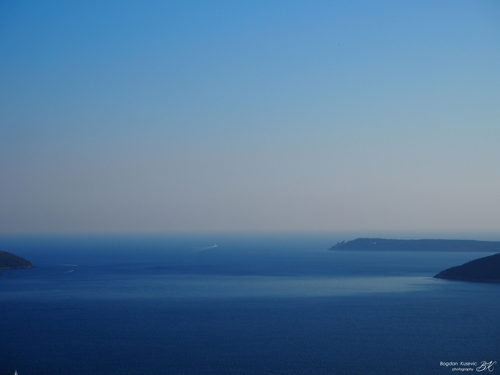
Muo is a settlement in the municipality of Kotor in Montenegro. According to the 2003 census, there were 677 inhabitants (according to the 1991 census, there were 740 inhabitants). Muo is an old fishing village that stretches 3 kilometres along the Bay of Kotor, on the south-eastern side of Vrmac hill, opposite Kotor and the southern part of Dobrota. It is 3 kilometres far from Kotor 2007-2017 Muo, the fisherman village (ita. Mulla) cover photo: Muo, summer seascape Muo is a settlement in the municipality of Kotor in Montenegro. According to the 2003 census, there were 677 inhabitants (according to the 1991 census, there were 740 inhabitants). Muo is an old fishing village that stretches 3 kilometres along the Bay of Kotor, on the south-eastern side of Vrmac hill, opposite Kotor and the southern part of Dobrota. It is 3 kilometres far from Kotor. Unlike other nearby settlements, whose development is mainly related to maritime affairs, the inhabitants of this village rely on fishing. Next
- Prcanj | Bay of Kotor | Cultural heritage project | Bogdan Kusevic
The town of Prcanj in Kotor municipality in Montenegro is a coastal town which traditionally relied on the maritime trade and such tradition has remained to the present day. Historically, the first mentions of it were in 1222 in the correspondence regarding the construction of St Johan Church. During the medieval age, the town was being developed in the upper level in the hill and it relied primarily on the local agriculture. 2007-2017 Prcanj (ita. Perzagno) cover photo: view towards Street of Lukovic Family in Prcanj Waves hitting on the stone piers- Prcanj, Montenegro - recorded by Bogdan Kusevic. april 2013 00:00 / 00:00 The town of Prcanj in Kotor municipality in Montenegro is a coastal town which traditionally relied on the maritime trade and such tradition has remained to the present day. Historically, the first mentions of it were in 1222 in the correspondence regarding the construction of St Johan Church. During the medieval age, the town was being developed in the upper level in the hill and it relied primarily on the local agriculture. Later, at the beginning of the 15th century, the town rapidly started to develop in the coastal region. Today Prcanj is well-known as a health resort, which was recognized at the congress of Yugoslavian pulmonologists in 1920s., and it attracts many visitors seeking for health improvement, sports training and family holiday in the peaceful scenery along the coast. It has a population of around 1,100. READ MORE on heritage article ''Prcanj, Montenegro" Next


